After weeks of “stay at home” we made a quick visit to the “West End” for a change of environment. The area offers many options for fun and interesting desert exploration within a 2-3 hour drive from Telluride.
The “West End” refers to the far western reaches of San Miguel and Montrose counties and is also the eastern most edge of the Colorado Plateau. The Dolores River bisects this zone and is fed by numerous side canyons where slick rock, pothole pools, springs, petroglyphys, historic mining and cowboy artifacts, and even dinosaur tracks can be found. After many years of exploration we have developed a pretty good familiarity with this region.
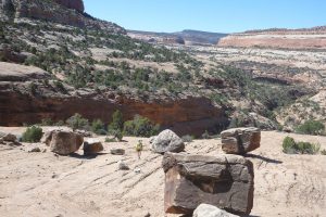
We decided to make a four day get away in late April of 2020 to check out some new sections and variations of past excursions. Established trails are mostly nonexistent so good map reading and navigation skills are required if venturing far from the high clearance roads that access these areas.
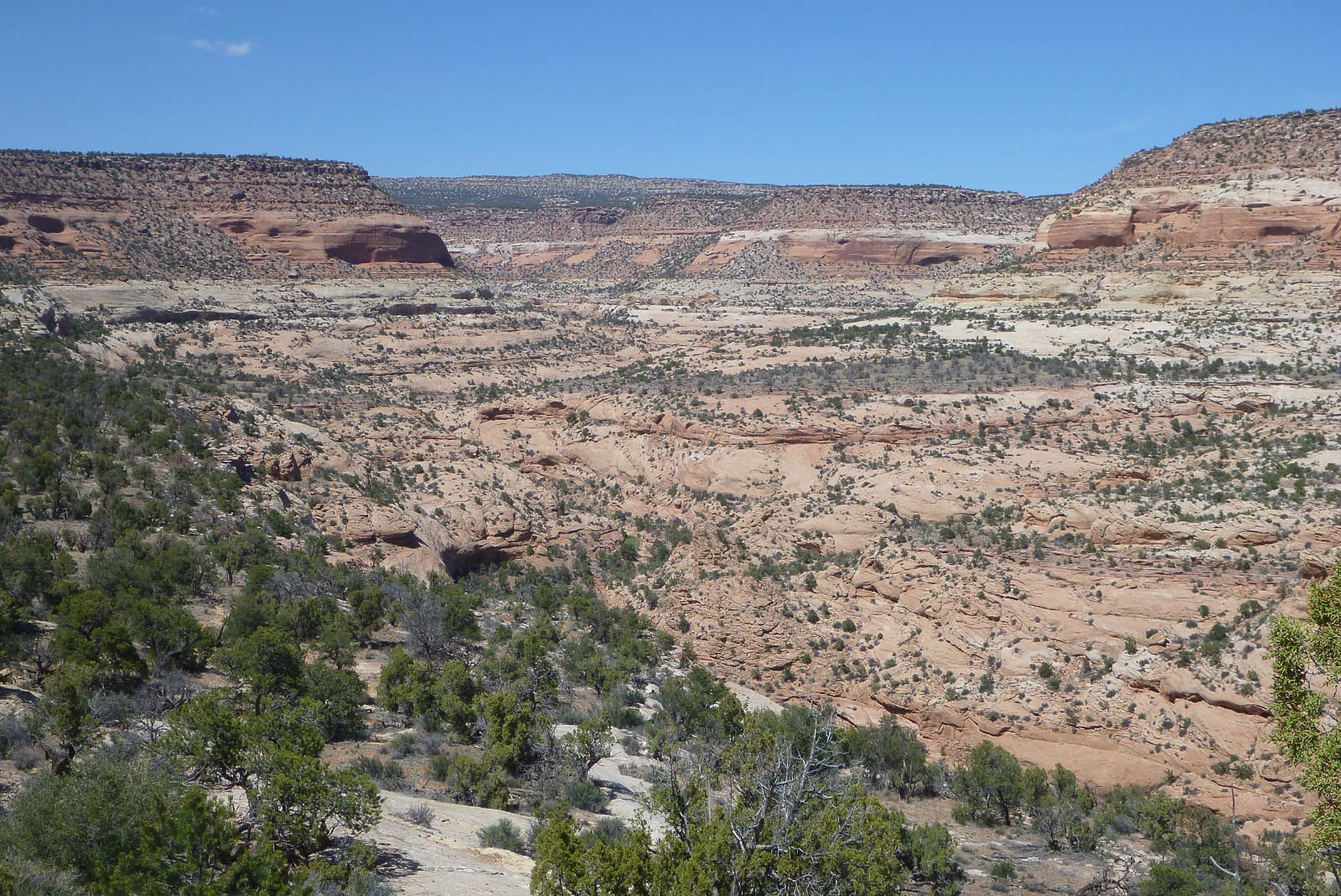
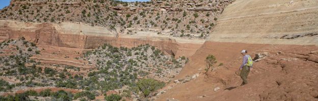
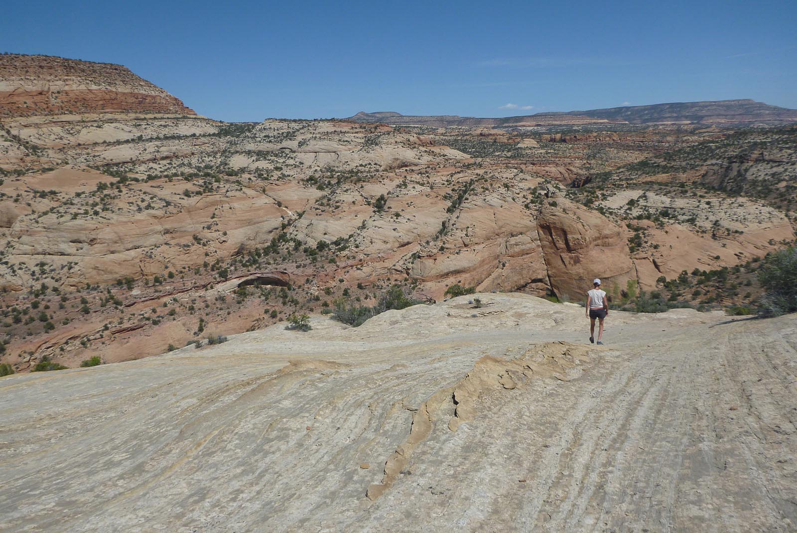
We left Telluride in the early morning and drove to the start of our first objective – a 2 night/3 day backpacking trip into one of the principle side canyons of the Dolores River. We left the truck around noon and after a quick side trip down to the river we spent the rest of our time in the seldom visited upper reaches of the canyon. We had not been into the upper part of this canyon before and found it to be quite impressive and worthy of the effort.
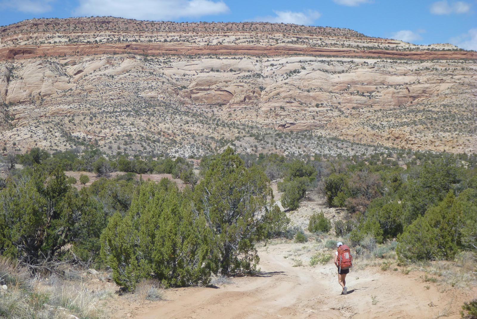
Twenty years previously, I hiked for the first time down this route to the river. On that inaugural trip, we left my truck at the start of the four wheel drive section and walked from there. The terrain is fairly complex with lots of little ridges and gullies going off in multiple directions over a large basin. It’s also a bit of a maze with different roads that criss-cross around the area to old mine workings, cattle gathering areas and etc. Most of these roads are not shown on the USGS 7.5 minute map.
Returning to the truck on that first trip we mistakenly got off on a different road then the one we had hiked down on. We had a general idea of where we had parked but… it was late autumn, the days were short and it was getting darker and colder by the minute. After some dead reckoning and cross country travel we thankfully located the truck just before full darkness hit. The next morning I reflected on how helpful it would have been to have had a GPS and set a waypoint for the truck. I ordered my very first GPS later that day and have used GPS technology extensively ever since. I consider it indispensable for the type of off trail travel through complex terrain that we often do.
On our recent visit I related this story to Karen and, with that past experience in mind, I set a way point at the truck. Walking down towards the river I couldn’t understand how we had gotten so turned around that first trip! The route seemed so straight forward… just follow the four wheel drive road. Sure enough, when we came back three days later we managed to get off on the wrong four wheeler road and ended up having to navigate a bit of cross country scrambling to get back to the truck. It would have been much more challenging, stressful and difficult without the USGS 7.5 minute map, a GPS and a waypoint for the truck. This was not the first time having a waypoint set for the vehicle has come in handy for us.
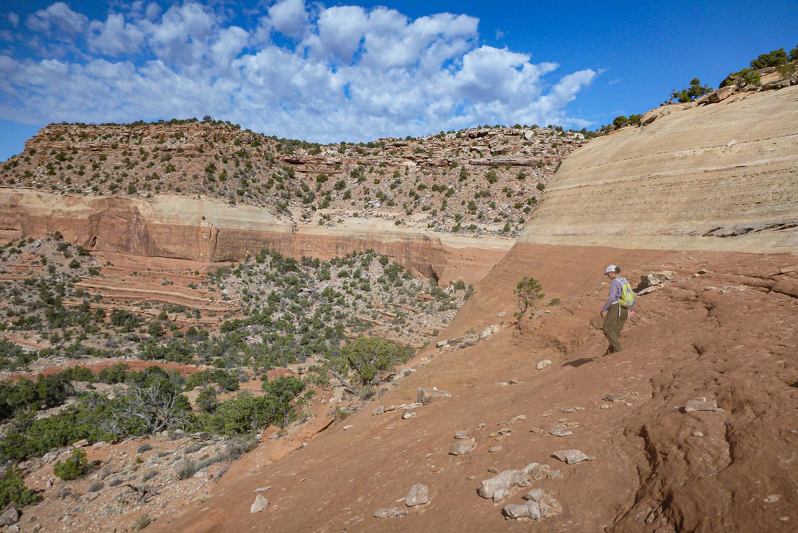
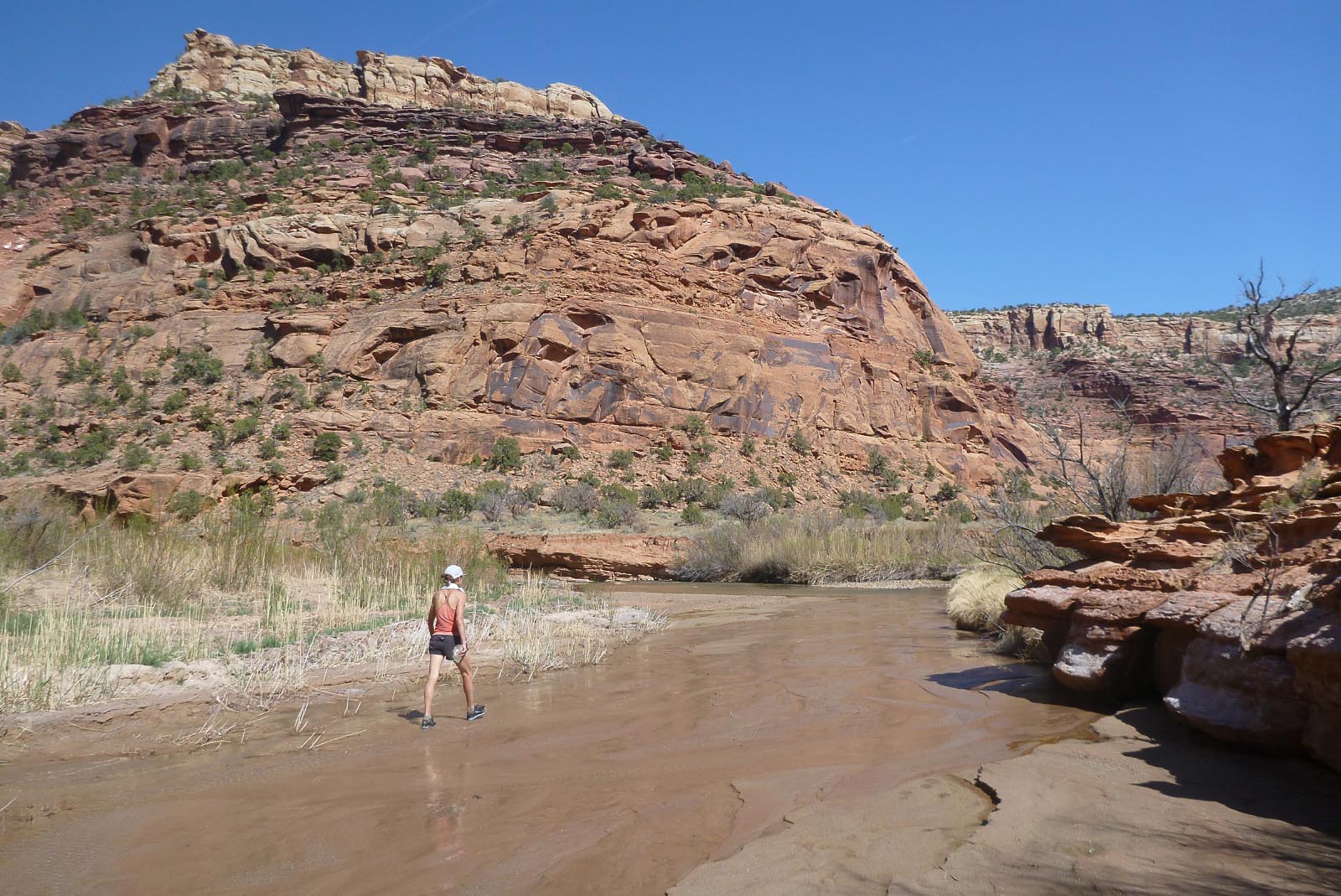
After a lunch break we drove to our second objective of the trip – another principle side canyon on the other side of the Dolores River. The typical collection of remote high clearance roads lead to the upper reaches and head waters of this very nice canyon.

I’ve been to this next canyon at least a half dozen time times but it had been about 10 years since my last visit. We arrived in the late afternoon and car camped on the rim that night at the head of one of the upper fingers that I had not yet explored. The next morning we started down the canyon which involved a bit of route finding and some scrambling to bypass several pour-overs. With lot’s of pools, beautiful slick rock, solitude and nice desert temperatures the canyon exceeded our expectations.
We returned via the same route we had descended, got back to the truck about three in the afternoon and headed for home. A great escape from the snow in the mountains and good to have an isolated change of environment without traveling too far. Once again the”West End” delivered!
Post Script: We went back! Memorial Day weekend temperatures across the region dropped 20 -25 degrees. High temps in the west end went from 90 to low 70’s. We accessed the same zone described at the beginning of this post, but this time we car camped on the mesa above and went in from the top. Two nights car camping and two days of hiking. We have plans to go back again. There is more to do in that zone!
Here is a link to a Slide Show from the trip.
Nice!
no problem social distancing
love the natural beauty!