We enjoyed another fine spring adventure in the canyon country wilderness. Two weeks allowed for two different backpacking loops with one day off in between. First a five day trip along the Paria River Canyon followed by a semi-aggressive, six day off trail loop starting from the North Rim of the Grand Canyon.
 We left Telluride in a wind storm and got as far as Mexican Hat, where we van camped. The next day we drove into Page, AZ and a bit farther to Big Water where long time friend Mike Friedman is setting up an incredible Desert Adventure Base. Nice house, huge shop and new military style canyon assault boat. We did not get to use the boat on this trip, Mike had it reserved for his own adventure with some VIP’s. We’ll get our turn.
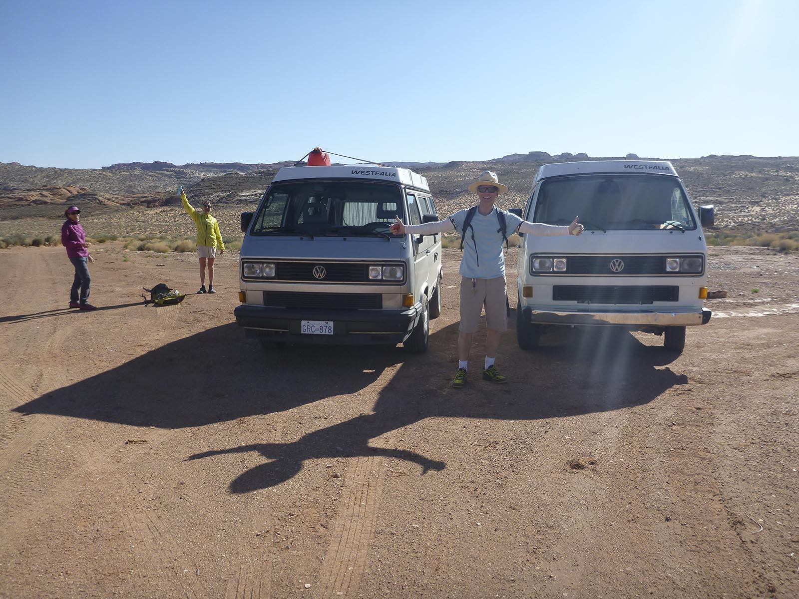 Saturday we met up with our friends, Carolyn and Sylvain, from Revelstoke, B.C. We sorted out our gear at Desert Adventure Base, drove out to the BLM ranger station to get our permit and then placed Karen’s van as a shuttle vehicle at Thousand Pockets.
The Paria and surrounding area is very tightly managed and regulated. It includes world famous Buckskin Gulch and The Wave at Coyote Buttes. To get a multi day back packing permit for the Paria you must apply, on line, four months in advance. I was stationed in front of my computer on the BLM reservation page on January 1 at 12:00 noon. At that moment permits for April become available and fill up within the hour. I secured one for four people for four nights.
The Paria has three principle trail heads. One is just below the ranger station on the main stem and is called “White House”. The other trail heads are “Buckskin Gulch”, a tributary of the Paria, and “Wire Pass” which is a side canyon of Buckskin.
Our plan was to start at Wire Pass. We had been down Buckskin from Wire Pass before and also had been in Buckskin another time or two from lesser known entry points. Buckskin is known as the worlds deepest, longest slot canyon. It is not technical but it is an adventurous hike. It’s 13 miles from Wire Pass down to the confluence where it joins the Paria. No camping spots or drinking water are available in that first 13 miles.
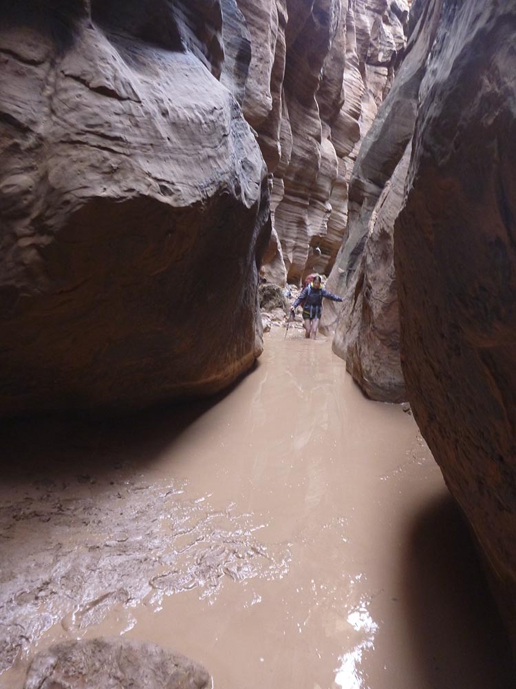 We had been told that there was neck and chest deep water in Buckskin but groups were going down. When we last did it, there were isolated shallow pools and it was not that cold. This day was quite different. We started early and it was a cool day. The sun does not really penetrate into the slot canyon. Right away we were in long stretches of waist deep, cold water. There was more wading in cold water than walking out of the water. We were not warming up in between the pools. It’s a stunning slot but unfortunately, due to conditions, it was kind of unpleasant that day. After an hour or so of this we looked at each other and pretty much simultaneously said, time for Plan B. We turned around, hiked back to Sylvain and Carolyn’s van at Wire Pass trail head, and then drove back to the White House trail head.
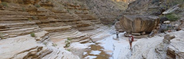
Going down the main stem of the Paria from the White House trail head was much more pleasant. We had definitely made the right call for our group. It’s open enough to get sun and the water is only ankle deep. These would be the conditions for the next four days. You cross and recross the Paria hundreds of times on the way to it’s end at Lee’s Ferry. Consequently, your shoes and feet are wet the entire time. We met several groups that had gone thru Buckskin that day. They all made it but none seemed very psyched.
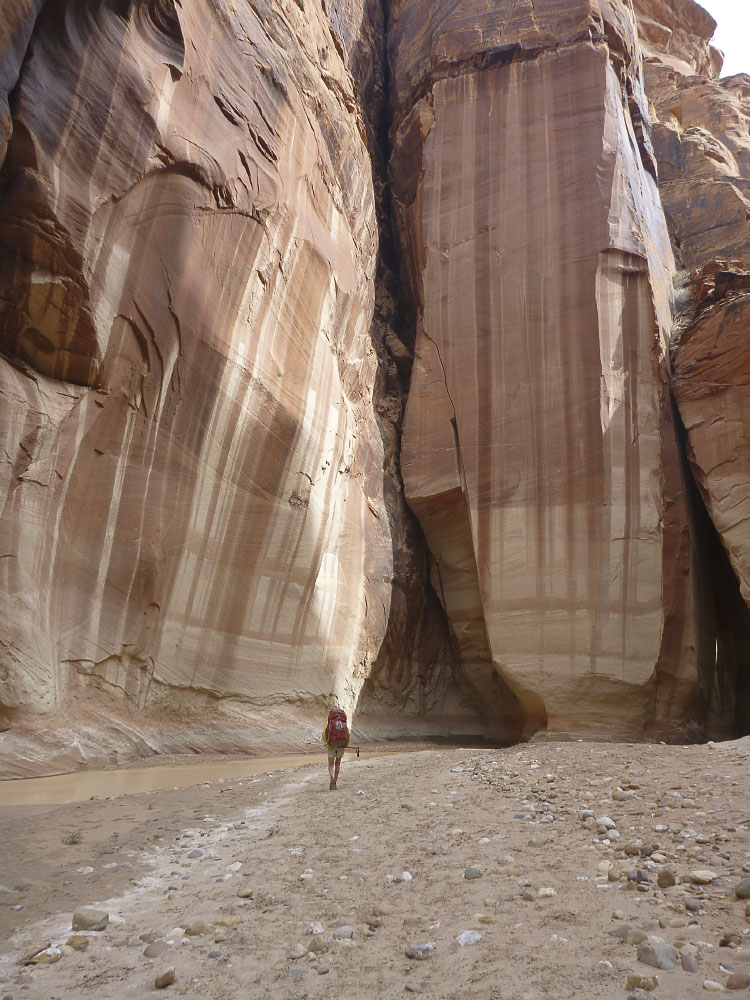 The first day included the Paria Narrows, a particularly beautiful section. We camped the first night just below the confluence with Buckskin near a spring. The water in the Paria is too turbid to effectively filter for drinking so springs along the way are used. The next three days were spent hiking down the Paria. It’s a great hike every step of the way, winding through an unspoiled Navajo Sandstone canyon with lovely camp sites on beaches under cotton wood trees.
On day four Sylvain and Carolyn headed out to make it all the way to Lee’s Ferry. Karen and I went most of the way but spent one more night out so we could be in position for our planned adventurous exit out to Thousand Pockets, where we had her van positioned.
 Our route out followed the historic route that the Dominguez/Escalante expedition used in 1776. It’s marked on the USGS 7.5 minute map but no actual trail exists. It involves route finding and ascending 1,800′ to a spot called Dominguez Pass. From there it was cross country to the van. It took us about 6.5 hours from the time we left the Paria. Somewhat challenging but cool. Not to be undertaken lightly or in bad weather. Good navigation skills and off trail desert hiking experience are required. We were glad to do it but it’s much easier and perfectly fun and advisable to end at Lee’s Ferry.
We were about 15 minutes from Big Water and we cruised back over to Desert Adventure Base where we hooked up with old friend and adventure partner, Ben. Ben was one of the VIP’s on the maiden voyage with the new boat and they had just returned from their loop around Navajo Mountain that same afternoon.
We did some wash, drank some beer, took showers, got organized, drank some more beer, got supplies, got further organized, had dinner and got ready to deploy the next day for the second mission. Ben would be joining us.
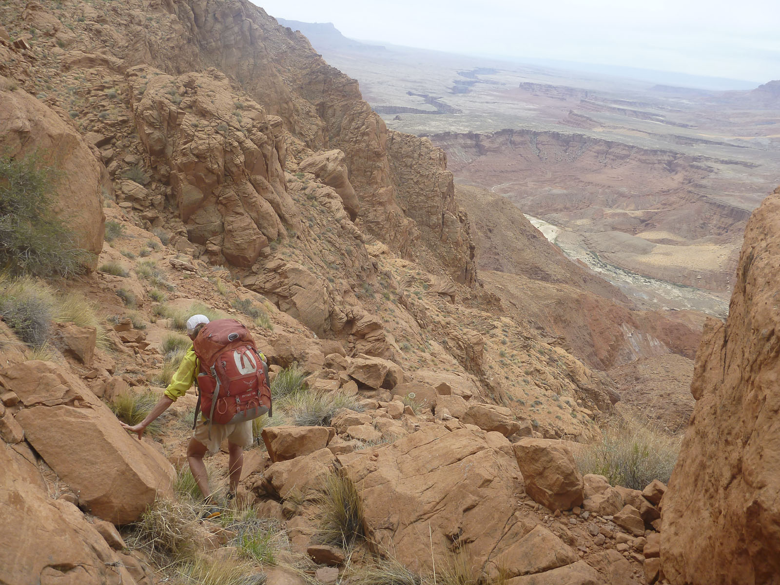
The next mission was a six day loop starting from the North Rim of the Grand Canyon. We would be following the Tuckup-Stairway Canyon route using beta from a guide book by George Steck. Stecks’ book provides more of a trip report than a detailed and specific route description. Interpretation and route finding are required every day.
Just getting to the trail head is a bit of an adventure involving navigating a network of high clearance two track roads for hours thru the forest and across the Kaibab Plateau. Mike and Ben had done the loop before but Ben had absolutely zero memory of any of it. Our original plan was for just Karen and I; Mike thought we could handle it. Ben joined on late in the planning. After doing it we agreed that we probably would not have pulled it off without Ben. Some of the roped climbing sections would have stretched our confidence and capabilities.
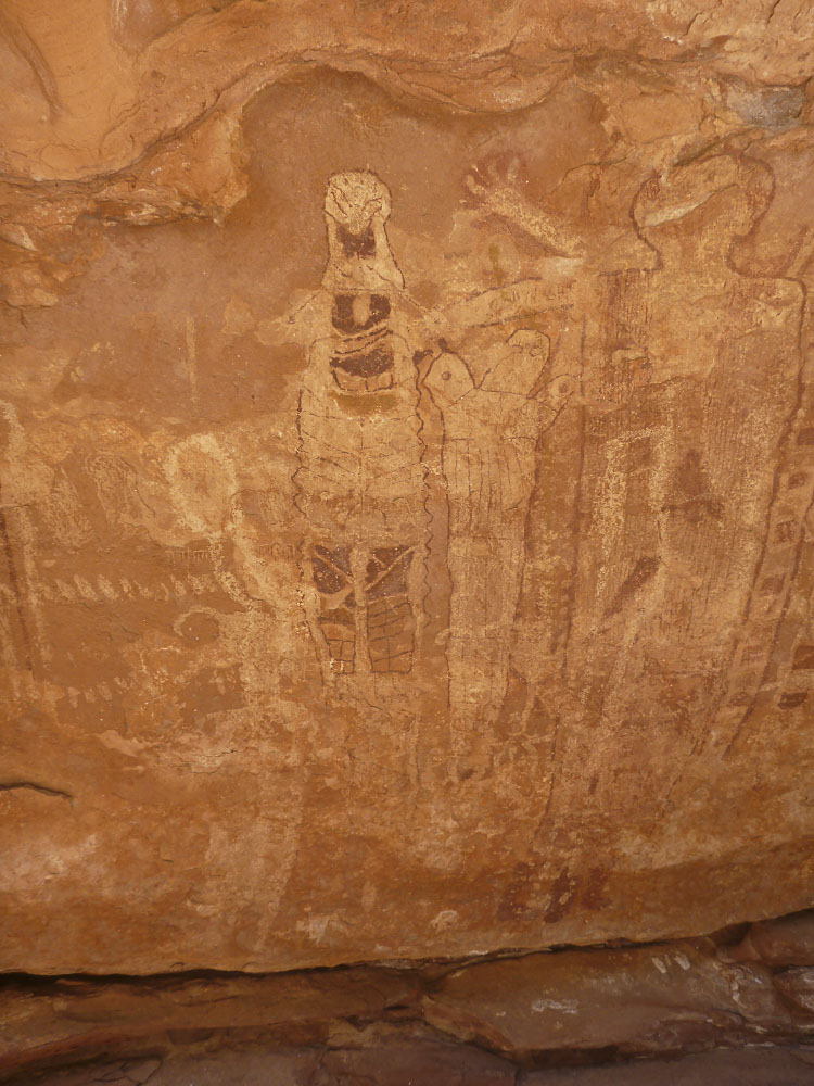 We started out just after noon and got off route within the first hour. After a short bit of re-tracing, we spent a nice day traveling down Tuckup Canyon. Along the way we stopped to admire the famous “Shaman Panel” pictographs. Stunning. Our first camp was at the junction with Cottonwood Canyon. There is a water source there, and lots of frog’s that make lots of noise until the moon goes down. The water needs to be filtered of course. It’s clear but it’s heavily mineralized and bitter. Take a lot of lemonade powder is my advice. It doesn’t make you sick but things become…..loose.
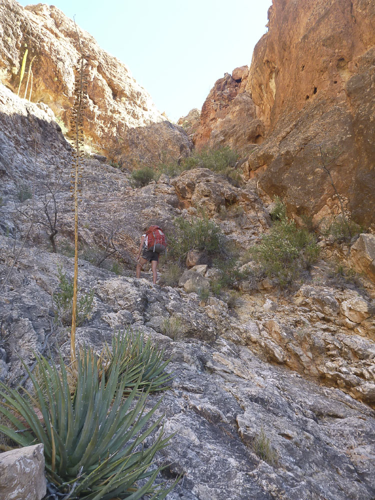
Heading down Tuckup is beautiful, lot’s of scrambling with some bypassing of pour overs required. Going through the Grand Canyon Redwall Limestone is always atmospheric. At the bottom of Tuckup, just before the river, there is a section of about 60′ of fairly serious down climbing. There is a bolt with no hanger at the top, and about 40′ down there is a reasonable ledge with another anchor, an old rusty landscape timber type nail, pounded into a crack.
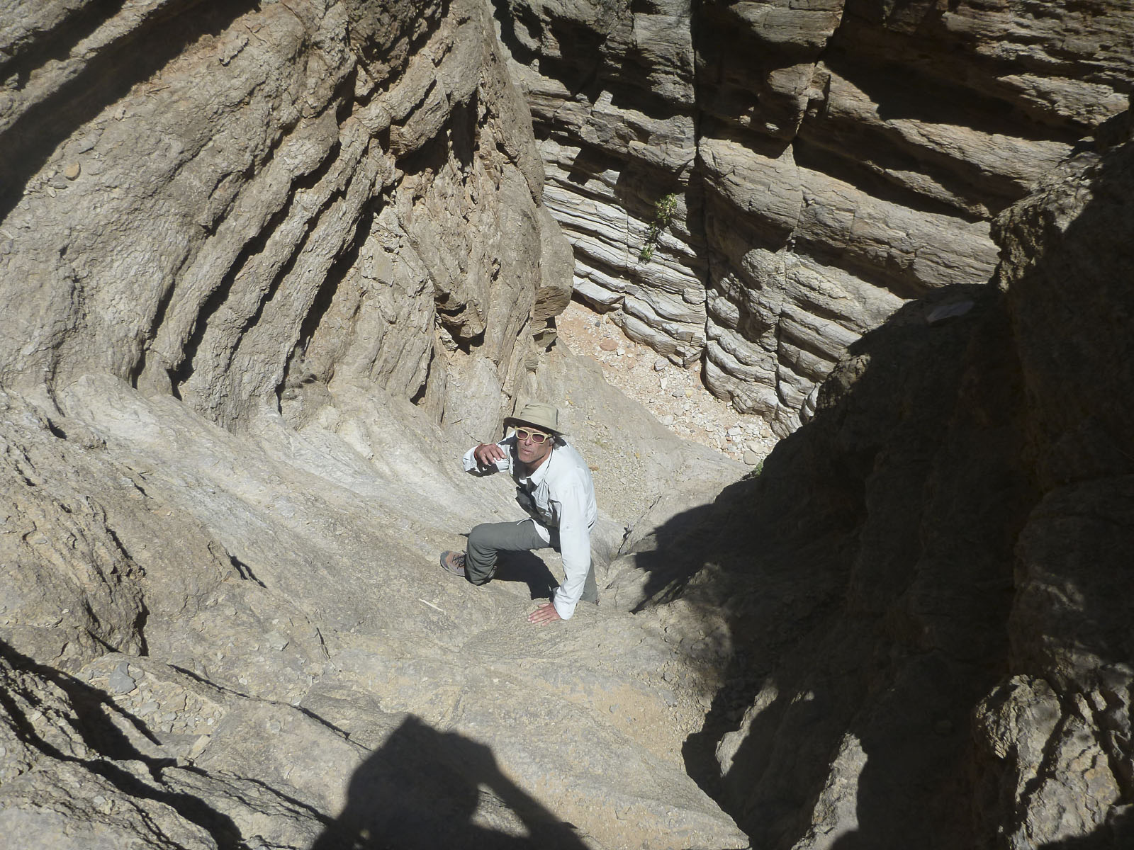 This is where we needed Ben. We were able to down climb, with our packs on, almost to the ledge while on belay from Ben who tied into the bolt. Just above the ledge was a sort of hard and exposed traverse move around a bulge that was much easier without a big pack pulling you backwards. There was a place to leave the packs, so we left the packs, went around the bulge and down onto the ledge where we could un-tie from the rope. Ben used the rope as a hand line and came down to the packs.He passed the packs down to us, climbed around the bulge down to the ledge we were on and pulled the rope.
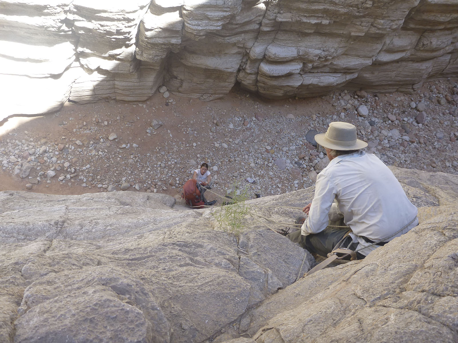 The next, last, pitch was shorter. A 20′ down climb to the canyon floor that was relatively easy without packs but I definitely wanted a belay. Karen went down first on belay. I tied the packs into the rope and passed them to Ben who lowered them to Karen. I went down next on belay. At the bottom while I was untying we heard “rock!”. A small golf ball size rock came down from 20′ up and hit Karen in the center of her forehead, just below her hairline. Quite a bit of blood started streaming down her face but the wound turned out to be relatively superficial. Treatment ultimately was a band aid and it healed within a week or so with no scar. Good thing she’s so tough!
Lesson learned. After the first pitch down to the ledge, I had said to Karen that we needed to move out of the way, so as to get out from under where Ben was climbing down to us, in case of rock fall. Why didn’t we do that when we got to the bottom of the last pitch on the canyon floor?
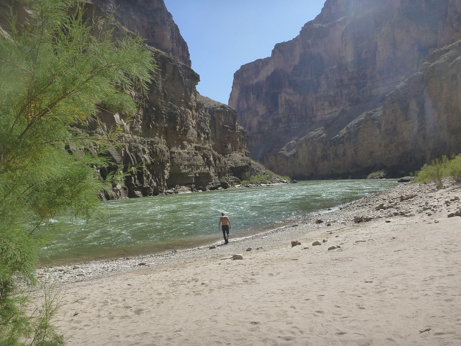 After achieving the canyon floor, it was a ten minute walk to the river. Stecks’ guide book group camped on the beach at the mouth of Tuckup. The next day they walked along the river, six miles, downstream to the mouth of Stairway Canyon. Steck, and Mike, described a pretty unpleasant thrash thru tamarisk on unstable side hill terrain. After a nice swim, some lunch and a little relaxation we succeeded in flagging down a raft trip that graciously agreed to take us downstream. It turned out the next few camp sites were already taken and they ended up getting us all the way down to Stairway. A super nice group of folks from various locales including Alaska and Salt Lake. We had mutual acquaintances and connections. They hooked us up with some wine and they had way more food then they could eat for dinner so… we agreed to help out with that.
 Now we were a day ahead of schedule. The next morning we headed up Stairway. Steck describes four “obstacles” that get progressively more difficult. The first two were no brainer’s. Number three spun us around for a few hours. The route description is confusing and we spent a lot of time going the wrong way, getting stopped, re-tracing and so on. There is a short section of belayed climbing and pack hauling going up the bypass. By the time we got past obstacle three it was mid afternoon and we were pretty scratched up, hot and tired. We had some food and went a bit further up and decided to camp at an OK spot that had some water. That was the right call. No longer ahead of schedule but still on track.
 The next morning we made an early start and got up to the final obstacle. It took some route finding but we zeroed in on the route fairly effectively. A stiff climb up loose talus and desert terrain to a final pitch of belayed rock climbing. Ben was able to climb up without protection, haul packs and then belay Karen and I. Once above this it was still more route interpretation and a long way up to the top end where Stairway Canyon meets the Esplanade.
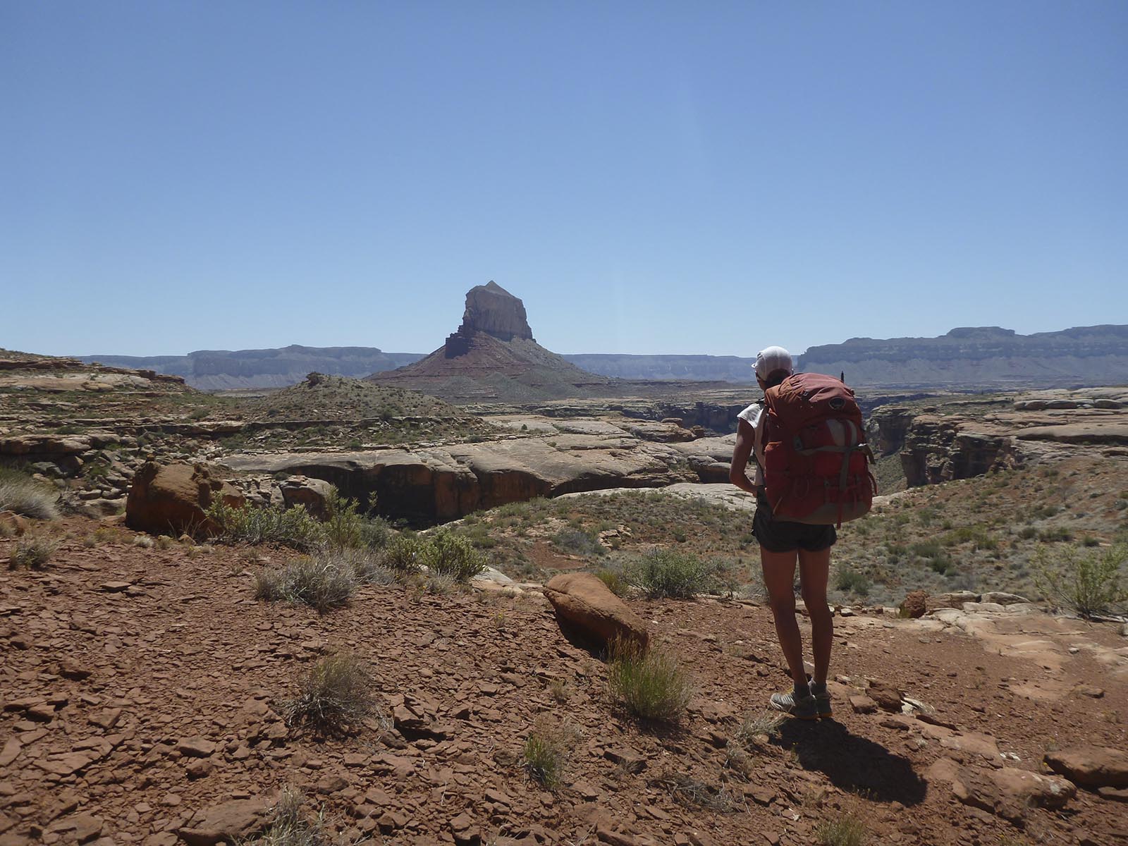
The Esplanade is a massive terrace in the Grand Canyon geology at about 4,200′ above sea level. The River is at about 2,200′. The trail head on the rim where we started and left our vehicles is at about 5,600′. Once on the Esplanade we needed to simply follow a heading until we intersected the Tuckup Trail and then follow that to our planned camp. The Tuckup Trail has multiple trial heads and traverses for many, many miles across and around the Esplanade. It is shown as an established Park Service trail on the USGS and National Geographic Trails Illustrated maps. We had started down from the trail head on the Tuckup Trail.
In the area of the Esplanade that we were in, the trail is non-existent. No trail, no cairns, no nothing. We followed along the general route of where it’s shown to be and eventually got to our next planned camp and water source, Willow Canyon Spring. I think that day was about 9 hours and probably in the low 80’s in the afternoon. We had started out with 3 liters of water each and we needed all of that. It was enough but we were out when we got to Willow Spring. Willow Spring has plenty of water, but it is not good water. It is quite bitter regardless of filtering. We did not get sick from drinking it but it definitely affected digestion and etc going forward. Enough said. I don’t see how you can complete this loop without using the spring, unless it happens to rain and you can get some pothole water along the way.
 The next day was spent traversing around and heading the many bays and side canyons that drain the Esplanade. Again, following the Tuckup Trail is a challenge. I’ve followed game trails that are much more established. It’s more a route than a trail. We started early and got to the next camp/water source, Cottonwood Spring, in about 6.5 hours. It was in the mid 80’s and again we carried and drank 3 liters of water each. Cottonwood Spring water is the same as Willow Spring. Not good, actually bad, not fatal, but necessary. Enough said.
We got started before 8:00 the next morning, made it across the rest of the Esplanade and up the last climb to the van by about 12:30. Whew, pretty vigorous route!
We drove back out to the highway and decided to treat ourselves to a night in Kanab. The Parry lodge is the only place I would consider staying there. Very cool and lot’s of western film making history. They show a free western movie in their barn each night.
 After enjoying the included breakfast buffet we drove as far as the Comb Ridge, just before Bluff. We got in a sweet afternoon loop hike up to the crest and back and had a cozy night in the van. In the morning we drove into Cortez, did some grocery shopping and got back to Telluride on Saturday at about 1:00.
Well that’s a very long post and good on you if you were able to read the entire thing! Here is a link to the photo highlights Slideshow.
Good job keeping it loose!