I provided view studies for two separate, but contiguous, projects. The two projects share the same hillside location on the sunny side of the Telluride Valley. The developers utilized the view studies as part of the Planning and Zoning approval process required for access and development of their respective properties.
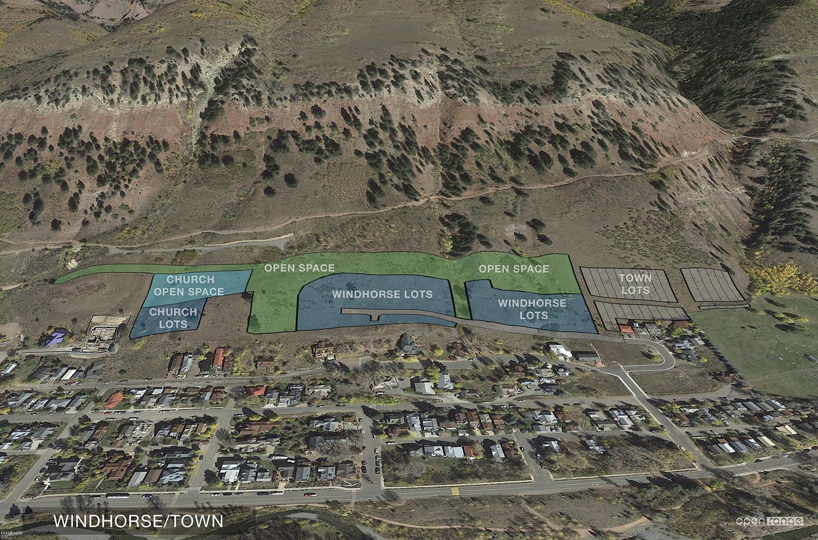
The larger of the 2 projects is the Windhorse Lots. The other project is called Church Lots.
The projects included a re configuration affecting 6 existing platted Town of Telluride blocks. I aligned and superimposed survey data over Google Earth imagery to illustrate the overall plan. Below are 2, out of a total of 12, images created utilizing Google Earth.
(click to enlarge)

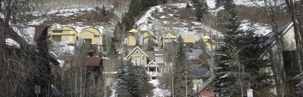
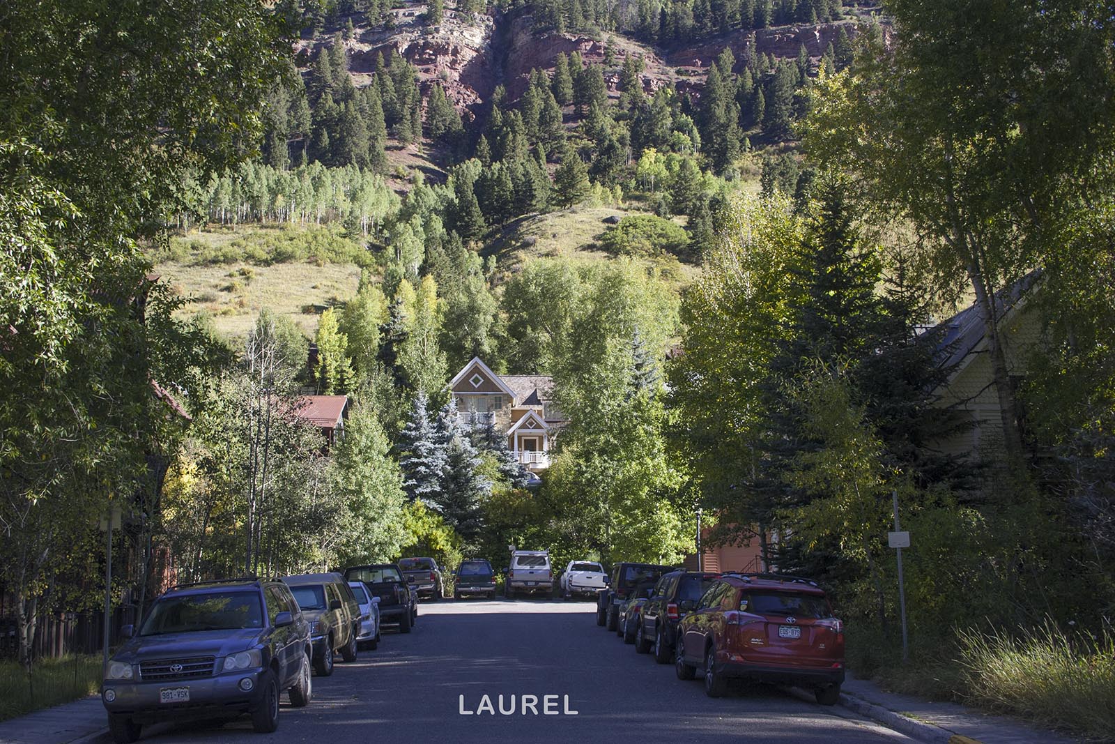
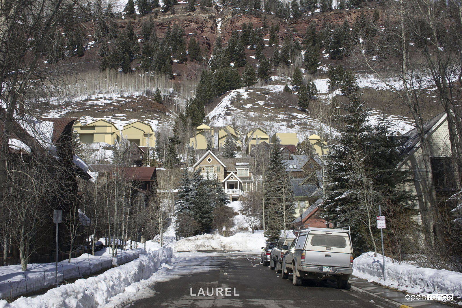
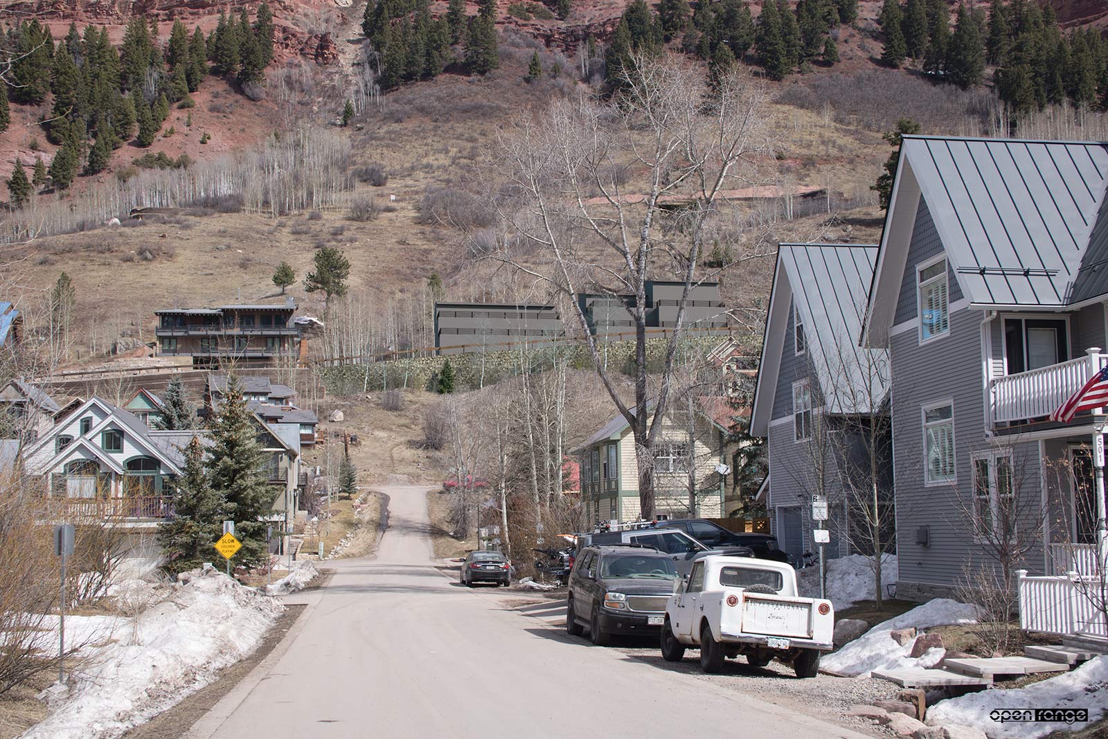
I was additionally contracted to produce accurate and verifiable photographic view studies showing the potential visual impact from surrounding areas. Due to the existing conditions of rising hillside with large homes and mature trees, the visual impact of the projects is limited. Views of the proposed development can only be seen by looking up the cross streets from below. When looking up towards the proposed development from mid-block, existing homes and trees completely obscure the developments.
Architectural mass and scale studies were completed. These resulted in proposed shape and size of potential homes based on lot size, slope and local zoning limits. I incorporated and positioned the corresponding 3D massing models within my overall CAD site model.
Both projects required road extensions and resulting retaining walls. The Eastern retaining structure was not visible from any of the view study vantage points. The Western most retaining wall was visible from a cross street view. I modeled and positioned the wall per the project civil engineer drawings and specifications. Bottom of wall, top of wall, guard rail, stone facing and landscape planting were all modeled textured and reproduced into the corresponding photography.
These architectural massing models and retaining wall elements can be seen in the accompanying view studies. In order to provide the most comprehensive treatment, the view studies were done in summer and also in winter after the leaves were off the trees. A few selected view studies are shown below.
(click to enlarge)

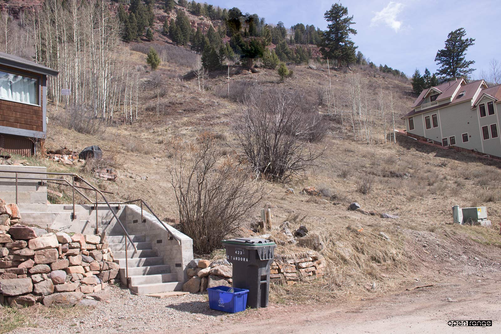
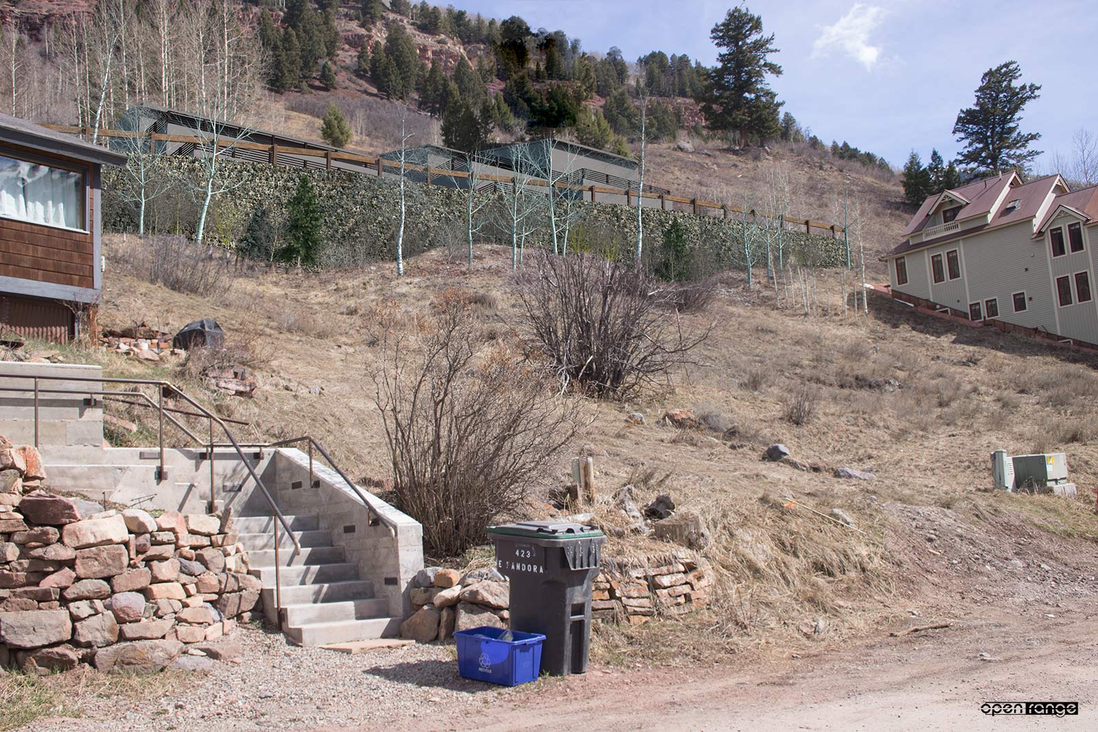
I completed the site photography in conjunction with the project surveyor Foley and Assoc. To achieve a verifiable level of accuracy, I had two survey crew members position themselves and hold 25′ tall grade rods on known block corners with-in the project. By incorporating the survey data into my software and reproducing the grade rods at their respective locations and elevations, accurate photo matching was achieved. I have described this process in a previous blog post.
As of this posting the Church Lots project has received final approval. The Windhorse Lots project has received the first of it’s three needed approvals. The renderings, illustrations and view studies were necessary and very instrumental in the respective projects review applications.